Image
The Inca Road System was one of the most impressive engineering achievements of the ancient Americas. Stretching across mountains, deserts, valleys, and tropical landscapes, this vast network connected distant communities and helped the Inca Empire maintain control over an enormous territory without modern vehicles or machinery.
Known as the Qhapaq Ñan, the network was much more than a collection of pathways. It supported communication, military movements, transportation of goods, religious activities, and administrative organization. Many sections were constructed in challenging environments where steep slopes, rivers, and unpredictable weather made travel extremely difficult.
Today, the remains of these ancient routes offer valuable insights into Inca engineering and Andean history. Here are seven fascinating facts that reveal how this remarkable transportation network worked.
The Inca Road System, also known as the Qhapaq Ñan, was an extensive network of roads connecting the territories of the Inca Empire, or Tawantinsuyu. It included major highways, secondary routes, bridges, stairways, and resting stations that allowed people and information to travel across vast distances.
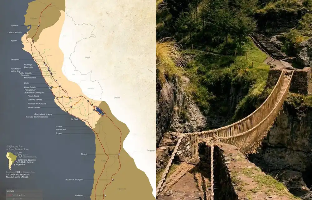
The network extended approximately 30,000 kilometers through territories now belonging to Peru, Ecuador, Colombia, Bolivia, Chile, and Argentina. Although the Incas significantly expanded and organized these roads, some routes originated with earlier Andean civilizations.
The Qhapaq Ñan developed from existing transportation routes used by ancient Andean societies. As the Inca Empire expanded during the 15th century, its rulers connected and improved these pathways to create a coordinated imperial network.
Construction methods varied according to geography. In mountainous regions, engineers built stone staircases and retaining walls, while flatter landscapes required different surfaces and route designs.
The road network crossed the Andes, Pacific coastal deserts, fertile valleys, and high-altitude plateaus. Two major longitudinal routes, one through the highlands and another along the coast, were connected by numerous secondary roads.
Cusco served as an important political and administrative center from which routes extended toward the empire's four major regions.
The Inca Road System was essential to the political, economic, and military organization of the empire. Without reliable transportation routes, governing territories separated by enormous mountains and long distances would have been considerably more difficult.
Beyond facilitating movement, the network helped authorities distribute resources, communicate instructions, and maintain relationships between administrative centers. Its infrastructure reflected the empire's capacity to organize labor and coordinate activities across diverse environments.
Tawantinsuyu was divided into four major regions: Chinchaysuyu, Antisuyu, Collasuyu, and Cuntisuyu.
The roads connected these regions with Cusco, allowing officials, messengers, and authorized travelers to move between administrative centers. This geographical integration supported the expansion and organization of the empire.
Efficient communication was essential for coordinating imperial activities. The roads enabled messengers to deliver information, while military groups could travel toward distant territories.
They also supported the movement of supplies and agricultural products through an organized system of storage facilities and resting stations.
Unlike modern commercial highways, however, these roads primarily served the administrative and logistical requirements of the imperial state.
The Inca Road System reveals remarkable details about ancient engineering, transportation, and communication. Its design demonstrates how Andean societies developed practical solutions for environments that remain challenging even today.
From suspension bridges to relay messengers, the following seven facts explain why the Qhapaq Ñan is considered one of South America's most significant historical achievements.
One of the most impressive facts about the Inca Road System is its extraordinary length. The network extended approximately 30,000 kilometers, connecting communities across six present-day South American countries.
Some roads crossed mountains above 4,000 meters, while others passed through dry coastal landscapes. This geographical diversity required different construction techniques and constant maintenance.
The network's enormous scale demonstrates the organizational abilities of the Inca Empire and the importance of transportation to its administration.
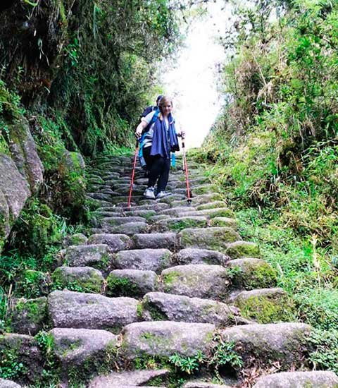
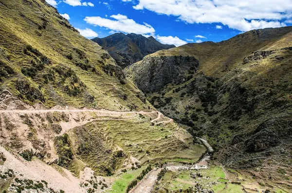
Inca engineers adapted road construction to some of the world's most demanding terrain. Mountain routes included stone staircases, drainage channels, and retaining walls designed to stabilize pathways.
In areas with heavy rainfall, drainage helped protect roads against erosion. On steep slopes, carefully arranged stones provided more secure passage.
Rather than forcing the landscape to accommodate a single design, engineers developed solutions suited to local environmental conditions.
The Incas developed an efficient communication network using trained runners known as chasquis.
These messengers traveled between designated relay stations, passing information to the next runner. This allowed messages to cover long distances without requiring one individual to complete the entire journey.
Chasquis communicated orally and could transport quipus, knotted-cord devices used for recording information.
Their work helped maintain communication between Cusco and distant administrative centers.
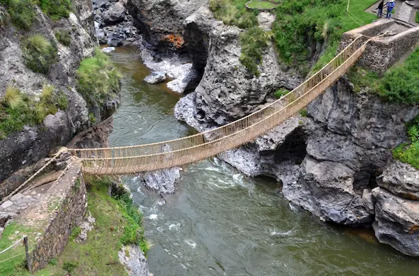
Crossing deep canyons and powerful rivers required innovative engineering solutions. The Incas used suspension bridges made from woven natural fibers to connect sections of their road network.
These bridges relied on thick ropes secured to strong anchor points. Their construction required specialized knowledge and cooperation among community members.
A remarkable surviving example of this tradition is the Q'eswachaka Bridge in the Cusco region, which local communities continue to renew using ancestral techniques.
Traveling across the Inca Road System required an organized network of support facilities. The Incas established tambos, stations that served administrative and logistical purposes.
Depending on their location, these facilities provided accommodation, supplies, and spaces for officials or travelers carrying out state responsibilities.
They were complemented by storage buildings called qullqas, which helped the empire manage provisions across different regions.
Unlike modern highways, Inca roads were not designed for wheeled vehicles.
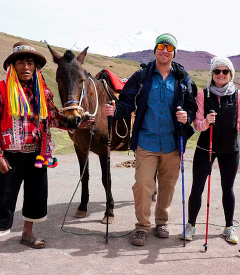
People traveled primarily on foot, while llamas transported certain goods and supplies. These animals were particularly useful because they were adapted to mountainous terrain and high elevations.
The network's staircases, narrow pathways, and steep mountain sections reflected these transportation methods.
How the Inca Road System Worked
This combination of infrastructure, labor, and transportation allowed the empire to function across enormous geographical distances.
Centuries after the fall of the Inca Empire, sections of the Qhapaq Ñan remain visible throughout the Andes.
Some pathways continue to serve local communities, while others form part of protected archaeological areas and historic trekking routes.
In 2014, UNESCO recognized the Qhapaq Ñan as a World Heritage Site because of its outstanding cultural and historical significance.
This recognition highlights the importance of preserving ancient infrastructure and the knowledge associated with its construction.
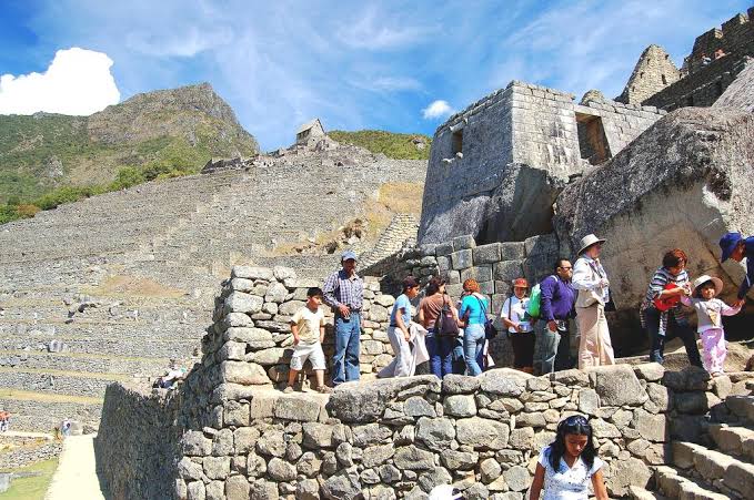
The Inca Road System is closely connected to the history of Machu Picchu. Ancient pathways provided access to settlements and ceremonial locations throughout the Cusco region, including the famous Inca citadel.
Today, visitors can observe surviving engineering features along historic routes, offering a tangible connection to the transportation network that supported the empire.
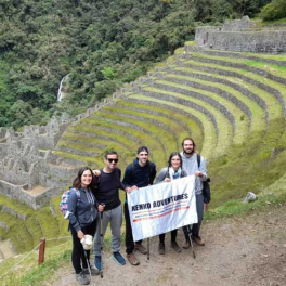
The famous Inca Trail to Machu Picchu forms part of the broader Inca road tradition.
Its stone staircases, mountain pathways, and archaeological remains demonstrate construction techniques used by ancient Andean engineers.
However, the Inca Trail represents only a small portion of the extensive network that once connected Tawantinsuyu.
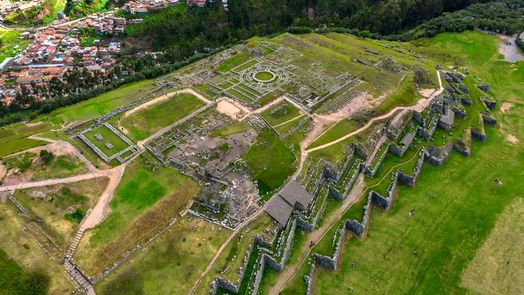
Travelers exploring Cusco and the surrounding Andes can encounter historic stone pathways, retaining walls, terraces, and archaeological sites associated with the Inca civilization.
These remains help illustrate how the ancient transportation system operated across mountainous environments.
Understanding their historical significance makes visiting archaeological sites and walking preserved routes a more meaningful cultural experience.
The Inca Empire expanded and organized the road network through state-directed labor. However, some routes were originally developed by earlier Andean civilizations and later incorporated into the imperial system.
The Qhapaq Ñan extended approximately 30,000 kilometers across western South America, connecting territories that now belong to six countries.
Their main purpose was to support communication, administration, military transportation, and the movement of supplies throughout the Inca Empire.
No. Horses were introduced to South America by Europeans. During the Inca period, people traveled mainly on foot, and llamas were used to carry certain loads.
Yes. Several preserved routes are accessible to visitors, including sections of the Inca Trail near Machu Picchu. Some require permits or authorized access to protect their archaeological significance.
The Inca Road System remains a powerful example of ancient engineering and political organization. Its roads, bridges, communication stations, and logistical infrastructure demonstrate how the Incas connected distant communities across challenging landscapes.
Beyond its historical importance, the Qhapaq Ñan represents an enduring part of Andean cultural heritage. Its surviving routes continue to reveal the ingenuity of the Inca civilization and the relationship between people, geography, and community cooperation.
For travelers visiting Peru, understanding this remarkable network offers a deeper appreciation of the history behind Cusco, Machu Picchu, and the ancient pathways of the Andes.